Tautenburg - Tautenburg
Tautenburg | |
|---|---|
| Coordonnées : 50°59′26″N 11°42′56″E / 50.99056°N 11.71556°E Coordonnées : 50°59′26″N 11°42′56″E / 50.99056°N 11.71556°E | |
| Pays | Allemagne |
| État | Thuringe |
| Quartier | Saale-Holzland-Kreis |
| Association municipale | Dornbourg-Cambourg |
| Gouvernement | |
| • Maire (2021-2027) | Wolf-Ullrich Weber |
| Surface | |
| • Le total | 12,71 km 2 (4,91 milles carrés) |
| Élévation | 230 m (750 pi) |
| Population
(2020-12-31)
| |
| • Le total | 288 |
| • Densité | 23/km 2 (59/mi²) |
| Fuseau horaire | UTC + 00:00 ( CET ) |
| • Été ( heure d'été ) | UTC + 02: 00 ( CEST ) |
| Codes postaux | 07778 |
| Indicatifs | 036427 |
| Immatriculation des véhicules | SHK, EIS, SRO |
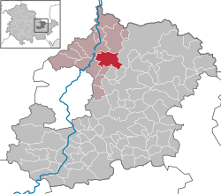
Tautenburg est une municipalité dans le district Saale-Holzland , en Thuringe , en Allemagne . Il abrite l' observatoire Karl Schwarzschild .
Les références


